May 14, 2026
- AI Technology
- Interior Design
How AI-First Insurers Can Use 3D Property Data to Transform Home Claims | VirtualSpaces
Hemanth Velury
CEO & Co-FounderHow AI-First Insurers Can Use 3D Property Data to Transform Home Claims Assessment
When a homeowner files a property damage claim, the insurer faces a question that sounds simple but rarely is: what did this home actually look like before the damage?
Right now, the answer is almost always inadequate. A handful of old photographs. A site visit report from an assessor who never saw the property pre-loss. A floor plan on paper, if the owner kept it. Sometimes, nothing.
This documentation gap is where claims fraud hides. It is also where legitimate claims get delayed, disputed, or undervalued, not because of bad faith, but because there was never a reliable spatial record of the property to begin with.
A new generation of AI-first insurers has already understood that better data produces better outcomes. What they have not yet fully operationalized is the most important data type of all: verified, photorealistic, spec-accurate spatial records of the homes they insure. AI 3D visualization is the technology that makes this possible, at scale, today.
The Insurers Already Thinking This Way
The shift toward data-native insurance is not theoretical. It is happening in real companies with real capital behind it.
Lemonade has built its entire operating model on AI-driven underwriting and claims processing. Its AI claims bot, Jim, can approve and pay certain claims in seconds, but only because it has structured data to work with. The constraint Lemonade faces, like every residential insurer, is that the underlying property data is still largely unverified and un-spatial.
Kin Insurance goes further by pulling in satellite imagery, aerial data, and property records to underwrite homes without requiring agent visits. Kin's model is explicitly about using external data signals to understand a property's risk profile before a human ever sets foot on it. Spatial interior data is the logical next layer: what is inside the home, how it is configured, and what it would cost to replace.
Fidelity National Financial, through its title and property data businesses, sits on one of the largest repositories of real estate records in the United States. As that data increasingly moves toward AI-driven analysis, the addition of verified interior spatial records becomes a natural extension of what the company already does.
Each of these companies is building toward the same destination: insurance underwriting and claims that are grounded in verified, queryable property data rather than self-reported declarations. Tools like Foursite and Remodroom by VirtualSpaces are precisely the infrastructure layer that closes the gap between exterior property data and interior spatial reality.
The Core Problem: Insurers Are Still Working Blind on the Inside
Kin can tell you a roof's age from satellite imagery. But it cannot tell you whether the kitchen has custom cabinetry or laminate finishes. Lemonade can process a claim in seconds if the data is clean, but if the pre-loss condition is disputed, the speed advantage evaporates. Fidelity knows everything about who owns a property; it knows very little about what the interior actually looks like.
This is the structural blind spot in residential property insurance globally: the exterior is increasingly well-documented, the interior almost never is.
The consequences are predictable:
-
Fraud vulnerability: Without a verified baseline, distinguishing genuine damage from inflated or fabricated claims depends on assessor judgment, not data
-
Assessment inconsistency: Two assessors visiting the same damaged property regularly produce materially different valuations
-
Delay and dispute: When pre-loss condition is unclear, every claim costs more to resolve and carries higher litigation risk
-
Mispriced risk: Policies covering high-finish homes are often priced the same as standard-finish homes because the insurer cannot verify the difference at inception
What AI-first insurers need is a spatial baseline: a verified, photorealistic, timestamped 3D record of a property's interior, captured at policy inception and queryable at any future point.
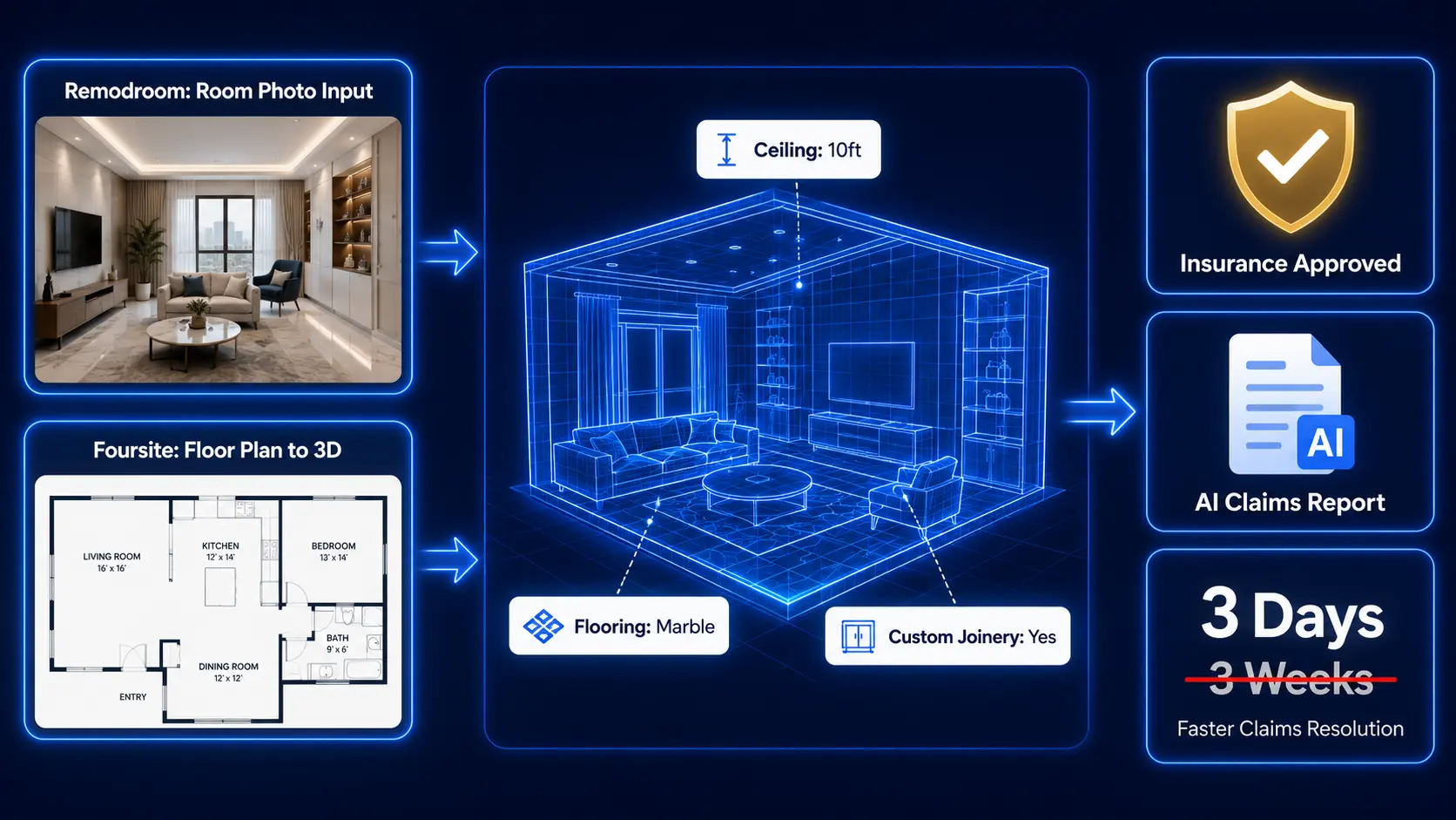
What Foursite and Remodroom Make Possible
Foursite by VirtualSpaces converts 2D floor plans and architectural blueprints into photorealistic AI 3D interior renders in minutes. The output is geometrically faithful: it reads actual room dimensions, wall relationships, door placements, and fixture positions from the source blueprint. The result is a spec-accurate, navigable 3D walkthrough of a property that did not previously exist in digital form.
Remodroom works from photographs. A homeowner uploads a photo of any room and Remodroom generates a photorealistic, spatially-aware 3D record of that space, preserving actual geometry while structuring the visual data into a queryable format. No architect required. No surveyor required. Just a smartphone photograph.
Together, they create two entry points for building an interior spatial baseline:
| Scenario | Input | Tool | Output |
|---|---|---|---|
| New home, plans available | 2D floor plan / blueprint | Foursite | Spec-accurate 3D walkthrough |
| Existing home, photos only | Room photographs | Remodroom | Photorealistic 3D room record |
| Post-renovation update | Updated plans + new photos | Foursite + Remodroom | Revised spatial baseline |
| Claims assessment | Post-loss photographs | Remodroom | Structured damage documentation |
This is infrastructure that any AI-first insurer can plug into their existing data pipeline. The inputs are documents homeowners already have. The outputs are structured spatial records that an AI claims engine can actually use.
Three Operational Use Cases for AI-First Insurers
Pre-Policy Spatial Documentation at Inception
The most powerful intervention is the simplest: build spatial baseline capture into the policy onboarding flow.
When a homeowner applies for residential property insurance, they already submit photographs, a property valuation, and sometimes a floor plan. None of these create a spatially accurate, queryable record. A floor plan to 3D conversion via Foursite, or a room-by-room photographic record processed through Remodroom, gives the insurer something entirely different, a verified spatial snapshot of the property at inception.
The onboarding workflow becomes:
I. Homeowner submits floor plan PDF or room photographs during application
II. Insurer runs inputs through Foursite or Remodroom to generate 3D spatial records
III. Records are timestamped, stored, and linked to the policy file
IV. At any future claim, the pre-loss baseline is immediately available for comparison
For Lemonade, this feeds directly into Jim's claims processing capability: instead of relying on self-reported descriptions of pre-loss condition, the AI works from a verified spatial record. For Kin, it extends their exterior data model into the interior. For Fidelity, it becomes a new layer of property intelligence attached to every policy in their book.
AI-Driven Pre/Post Claims Comparison
With a pre-loss spatial baseline in place, the claims assessment process changes structurally. The assessor's job shifts from reconstruction to verification.
Current State (industry standard):
-
Assessor visits damaged property
-
Manual documentation: 1-3 days
-
Report preparation: 3-5 days
-
Dispute resolution, if any: weeks to months
-
Average full cycle: 3-8 weeks
With Spatial Baseline:
-
Homeowner submits post-loss photographs
-
Remodroom converts photos to structured 3D record: hours
-
AI compares pre-loss and post-loss spatial models: hours
-
Preliminary damage scope report generated: same day
-
Assessor visit focused on verification, not discovery
-
Average full cycle: days
The damage scope report produced by this process identifies which elements were affected, what their pre-loss specification was, and what replacement costs are based on current material pricing. This is the kind of structured output that Lemonade's AI infrastructure is built to consume, and that Kin's underwriting model can use to close the loop between risk assessment and claims outcome.
Fraud Detection Through Spatial Inconsistency Analysis
Property insurance fraud costs the global insurance industry an estimated $80 billion annually. A significant portion involves interior misrepresentation: claiming damage to finishes or fixtures that were never present, inflating the quality of interiors, or fabricating high-value elements after the fact.
A pre-loss AI 3D visualization record makes most of these fraud vectors structurally difficult to execute:
-
A claim for destroyed imported marble flooring is immediately compared against a pre-loss record showing ceramic tile
-
A claim including a custom home theater system is checked against a baseline that shows a standard living room
-
A claim inflating room count is verified against a geometrically accurate floor plan record
The deterrence effect compounds over time. When policyholders know a verified spatial record exists at inception, the incentive to inflate claims decreases before a claim is ever filed. This is not just a claims improvement, it is an underwriting quality improvement that reduces loss ratios at the portfolio level.
The Underwriting Angle: Spatial Data as a Pricing Signal
Beyond claims, interior spatial data has significant implications for how AI-first insurers price residential risk.
Currently, residential property insurance pricing relies heavily on declared values, broad property classifications, and location-based risk signals. Very little of it is based on verified, property-specific data about interior configuration, construction quality, or finish specification.
A blueprint to 3D record at inception changes the available data entirely. An insurer can now verify:
-
Actual room count and spatial layout
-
Construction and finish quality, visually confirmed
-
High-value elements: custom joinery, premium appliances, specialty fixtures, art installations
-
Structural features that affect risk: number of floors, open-plan layouts, internal staircase placement
This is the foundation of genuine risk-based pricing for residential properties. Homes with higher replacement costs can be identified and priced correctly at inception. Homes with lower-risk spatial configurations can be offered better rates. The pricing signal is grounded in verified interior reality, not self-declared estimates.
For companies like Kin, which already prices based on property-specific data signals, adding verified interior spatial records is a natural and potentially significant underwriting edge.
The Global Insurtech Opportunity
Residential property insurance is chronically underpenetrated in most markets. In the United States, approximately 6% of renters carry renter's insurance despite most leases recommending it. In India, residential property insurance penetration remains below 1% of the insurable base. In Southeast Asia, the gap is similar.
A key reason is that the product has never felt worth the friction. The onboarding is cumbersome, the value proposition is abstract, and the claims experience, when it comes, is often slow and contested.
Spatial documentation built into the policy changes the value proposition at both ends:
-
At inception: Documenting your home for insurance becomes a benefit in itself. Homeowners get a photorealistic 3D record of their property, a verified spatial inventory that has value well beyond insurance, as a renovation reference, a moving record, or a resale asset
-
At claims time: The process becomes faster, more transparent, and less adversarial. Homeowners with a pre-loss baseline get faster settlements. That is a communicable, concrete benefit that drives both purchase intent and renewal rates
This is also a genuine product design opportunity. Insurtech companies that bundle spatial documentation into their policy offering, powered by AI interior design visualization infrastructure, are creating a differentiated product experience that traditional carriers cannot easily replicate.
Lemonade's brand promise is radical transparency. A verified spatial record at inception is, structurally, the most transparent thing an insurance product can offer. Kin's brand promise is data-native underwriting. Interior spatial data is the most complete data signal available for residential properties. The alignment between these brand positions and what Foursite and Remodroom deliver is not incidental, it is direct.
Implementation: Lower Barrier Than Expected
The barrier to implementing spatial baseline documentation is lower than most insurance product teams expect. It does not require:
-
Mandatory field surveys or site visits
-
Proprietary hardware, sensors, or lidar devices
-
Complex core system integrations to get started
-
High levels of homeowner technical sophistication
What it requires is a structured document collection step at inception, with the convert floor plan to 3D or photograph-to-3D conversion handled entirely on the platform side.
A natural pilot structure for any insurer exploring this:
-
Segment: New residential policies in the $500,000+ property value tier, or policies tied to new home purchase transactions where floor plan documentation already exists
-
Duration: 6 months
-
Metrics: Claims cycle time, fraud detection rate, assessment cost per claim, customer satisfaction scores
-
Comparison: Documented vs. undocumented policies in the same cohort
The data from a pilot of this structure would produce a compelling case for broader rollout, and a defensible ROI for spatial documentation as a standard underwriting input.
Spatial Clarity Is a Risk Management Foundation
The insurance industry has spent decades building better actuarial models, better pricing algorithms, and better fraud detection systems. All of them are ultimately limited by the quality of the underlying property data.
Companies like Lemonade, Kin, and Fidelity are already operating at the frontier of what is possible with the property data that currently exists. AI interior design renders and spatial modeling tools like Foursite and Remodroom are the next layer: verified, photorealistic, queryable records of what a home actually contains, captured before loss, and available at claims time.
The insurers who build spatial documentation into their onboarding process now will have a data advantage that compounds with every policy they write. The ones who wait will continue resolving claims the same way they do today: manually, slowly, and with inadequate evidence.
Spatial clarity is not a product feature. It is a risk management foundation.
Want to explore how Foursite and Remodroom can integrate into your property documentation workflow? Write to us: reachus@virtualspaces.tech
Recommended for you

July 29, 2026
Kitchen and Bath: The Two Rooms That Decide Resale | VirtualSpaces
HHemanth Velury
CEO & Co-Founder
July 27, 2026
Why Empty Rooms Don't Sell: Virtual Staging | VirtualSpaces
HHemanth Velury
CEO & Co-Founder
July 24, 2026
The Quiet Sustainability Win of Deciding in 3D | VirtualSpaces
HHemanth Velury
CEO & Co-Founder
July 22, 2026
Why Paint Swatches Lie: Test Color in 3D First | VirtualSpaces
HHemanth Velury
CEO & Co-Founder
July 20, 2026
Why Every Home Should Be Seen Before It's Built | VirtualSpaces
HHemanth Velury
CEO & Co-Founder
July 17, 2026
Why Big AI Labs Won't Build Floor Plan to 3D | VirtualSpaces
HHemanth Velury
CEO & Co-Founder
July 15, 2026
How We Solve Floor Plan to 3D, Accurately | VirtualSpaces
HHemanth Velury
CEO & Co-Founder
July 13, 2026
Designing Homes That Age With the People in Them | VirtualSpaces
HHemanth Velury
CEO & Co-Founder
July 10, 2026
Designing Spaces for How Light Actually Moves | VirtualSpaces
HHemanth Velury
CEO & Co-Founder
July 08, 2026
Designing Homes for Every Life Stage in 3D | VirtualSpaces
HHemanth Velury
CEO & Co-Founder
July 06, 2026
Build an Interior Design Portfolio Without Clients | VirtualSpaces
HHemanth Velury
CEO & Co-Founder
June 26, 2026
AI Interior Design: Full 3D Workflow in One Platform | VirtualSpaces
HHemanth Velury
CEO & Co-Founder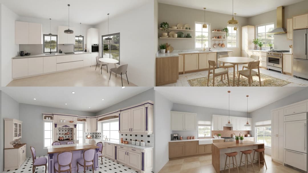
June 24, 2026
Scope Creep in Interior Design: How AI Visualization Fixes It | VirtualSpaces
HHemanth Velury
CEO & Co-Founder
June 22, 2026
What Buyers See on a Floor Plan: Your Biggest Sales Problem | VirtualSpaces
HHemanth Velury
CEO & Co-Founder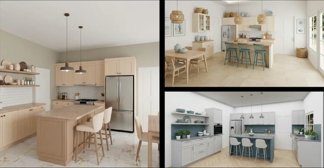
June 19, 2026
Small Design Studios vs Big Firms: The AI Advantage | VirtualSpaces
HHemanth Velury
CEO & Co-Founder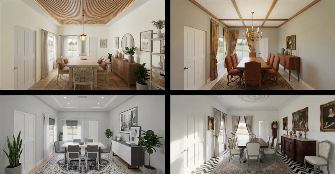
June 17, 2026
After the Mood Board: AI Interior Visualization | VirtualSpaces
HHemanth Velury
CEO & Co-Founder
June 15, 2026
Foursite Pro Editor: Full Floor Plan Control for Designers | VirtualSpaces
HHemanth Velury
CEO & Co-Founder
June 12, 2026
AI Interior Design: Style Any Room in Seconds with Foursite | VirtualSpaces
HHemanth Velury
CEO & Co-Founder
June 10, 2026
Foursite: Floor Plan to 3D Walkthrough in Minutes | VirtualSpaces
HHemanth Velury
CEO & Co-Founder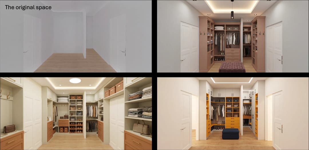
June 08, 2026
Win More Pitches With AI Renders Before the Meeting | VirtualSpaces
HHemanth Velury
CEO & Co-Founder
June 05, 2026
From Floor Plan to Finished Room: What AI Now Makes Possible | VirtualSpaces
HHemanth Velury
CEO & Co-Founder
June 03, 2026
The Interior Design Brief Is Broken. AI Fixes It | VirtualSpaces
HHemanth Velury
CEO & Co-Founder
June 01, 2026
Pre-Construction Home Sales: AI Interior Visualization Guide | VirtualSpaces
HHemanth Velury
CEO & Co-Founder
May 30, 2026
Interior Design Principles: Applied with AI | VirtualSpaces
HHemanth Velury
CEO & Co-Founder
May 28, 2026
Designing Spaces for People, Not Blueprints | VirtualSpaces
HHemanth Velury
CEO & Co-Founder
May 26, 2026
The Future of Interior Design: Closing the Visualization Gap with Foursite and Remodroom | VirtualSpaces
HHemanth Velury
CEO & Co-Founder
May 18, 2026
How AI Visualization Upgrades Property Data Platforms | VirtualSpaces
HHemanth Velury
CEO & Co-FounderMay 12, 2026
Why Photoreal 3D Renders Are Replacing Mood Boards | Interior Design Client Presentations | VirtualSpaces
HHemanth Velury
CEO & Co-Founder
May 08, 2026
From 2D Floor Plans To Living Worlds: The Spec‑Accurate 3D Engine | VirtualSpaces
HHemanth Velury
CEO & Co-Founder
May 06, 2026
Why Furniture Brands Need AI 3D Visualization Now | VirtualSpaces
HHemanth Velury
CEO & Co-Founder
May 4, 2026
How Property Portals Can Turn 2D Floor Plans into 3D Design Decisions | VirtualSpaces
HHemanth Velury
CEO & Co-Founder
April 29, 2026
The Home-Fit Test: Why Square Footage Misleads | VirtualSpaces
HHemanth Velury
CEO & Co-Founder
April 27, 2026
Designing Homes That Sell: 3D Visualization ROI Data | VirtualSpaces
HHemanth Velury
CEO & Co-FounderApril 24, 2026
What's Next: Foursite & Remodroom's New AI Features | VirtualSpaces
HHemanth Velury
CEO & Co-Founder
April 22, 2026
AI in Architecture: Closing the 85% Exposure Gap | VirtualSpaces
HHemanth Velury
CEO & Co-Founder
April 20, 2026
Interior Design Pricing in 2026: From Hourly to Value-Based Fees | VirtualSpaces
HHemanth Velury
CEO & Co-FounderApril 17, 2026
How Foursite and Remodroom Help Designers Win Clients | VirtualSpaces
HHemanth Velury
CEO & Co-Founder
April 15, 2026
Designing Spaces for People: Remodroom + Foursite AI Guide | VirtualSpaces
HHemanth Velury
CEO & Co-Founder
April 13, 2026
Designing for the Way People Actually Live: How AI 3D Is Finally Closing the Gap Between Floor Plan and Reality
HHemanth Velury
CEO & Co-Founder
April 11, 2026
Design in Real Time: AI Renders in Your First Client Meeting
HHemanth Velury
CEO & Co-Founder
April 06, 2026
Why Real Estate Photography Is No Longer Enough: The Shift to Spatial-First Listings
HHemanth Velury
CEO & Co-Founder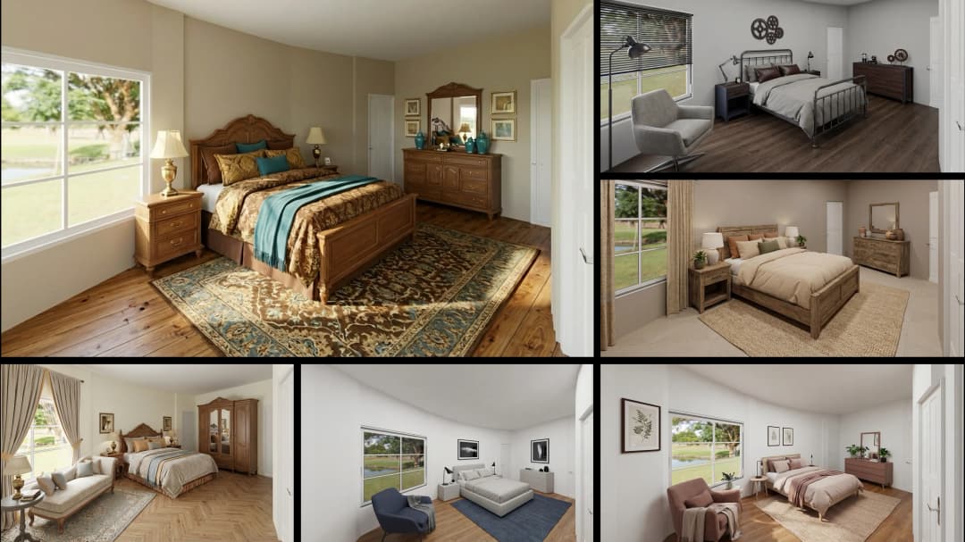
April 03, 2026
Property Management's Hidden Weapon: AI 3D Floor Plans That Cut Vacancy Time and Raise Tenant Quality
HHemanth Velury
CEO & Co-Founder
April 01, 2026
Off-Plan and Oversubscribed: How AI 3D Visualization Is Transforming Real Estate Pre-Sales
HHemanth Velury
CEO & Co-Founder
March 30, 2026
Why Foursite Beats Generic AI Tools for Interior Design 3D Visualization
HHemanth Velury
CEO & Co-Founder
March 27, 2026
7 Tenets of Interior Design: How AI Accelerates Harmony in Residential Spaces
HHemanth Velury
CEO & Co-Founder
March 25, 2026
What Is the 3-5-7 Rule in Interior Design? Foursite's AI Guide for Residential Spaces
HHemanth Velury
CEO & Co-Founder
March 23, 2026
What Is the 70/30 Rule in Interior Design? Foursite's AI Guide for Residential Spaces
HHemanth Velury
CEO & Co-Founder
March 20, 2026
How AI 3D Visualization Is Rewriting Residential Interior Design Workflows
HHemanth Velury
CEO & Co-Founder
March 18, 2026
Beyond Marketing: How 3D Floorplans Transform FM, Retrofit Planning & ESG Operations
HHemanth Velury
CEO & Co-Founder
March 16, 2026
Why AI Companies Use Token Payments (And Why VirtualSpaces Is Returning To Fiat)
HHemanth Velury
CEO & Co-Founder
March 13, 2026
Floorplan‑Native Digital Twins: Beyond BIM for Consumer‑Ready Real Estate Experiences
HHemanth Velury
CEO & Co-Founder
March 11, 2026
The Foursite Platform Thesis: Why Floor Plans, Not Photos, Are the Next Property Software Primitive
HHemanth Velury
CEO & Co-Founder
March 09, 2026
Design Systems for Space: Building Reusable 3D Component Libraries on Top of AI Floorplan‑to‑3D Engines
HHemanth Velury
CEO & Co-Founder
March 06, 2026
How to Standardize Design Quality Across Global Projects Using AI Floorplan-to-3D Tools
HHemanth Velury
CEO & Co-Founder
March 04, 2026
From CAD-First to AI-First: Reskilling Your Team for AI-Native Design Workflows
HHemanth Velury
CEO & Co-Founder
March 02, 2026
Algorithmic Ergonomics Meets Photorealistic 3D: Designing Human-Centered Smart Homes with Foursite in 2026
HHemanth Velury
CEO & Co-Founder
February 27, 2026
The Ethics of AI in Interior Design: Ownership, Originality, and Client Transparency
HHemanth Velury
CEO & Co-Founder
February 25, 2026
Designing with Empathy: Using AI 3D Visualization to Improve Client Communication and Emotional Clarity
HHemanth Velury
CEO & Co-Founder
February 23, 2026
From Tool to Infrastructure: AI Floorplan-to-3D and the Next Wave of PropTech
HHemanth Velury
CEO & Co-Founder
February 20, 2026
AI Interior Design for Holiday Homes: Turn Spare Flats into High-Demand Short-Stay Rentals with 3D Visuals
HHemanth Velury
CEO & Co-Founder
February 18, 2026
The Pre‑Purchase Power Play: How Savvy Home Buyers Use 3D Floor Plan Visualization to Negotiate Better Deals
HHemanth Velury
CEO & Co-FounderFebruary 16, 2026
AI Interior Design for Non‑Designers: How Homeowners Can Brief Like Pros
HHemanth Velury
CEO & Co-Founder
February 13, 2026
Scaling a Design Business Without Hiring a 3D Team: An Owner's Guide
HHemanth Velury
CEO & Co-Founder
February 11, 2026
From Bland to Bold: How to Rescue Builder-Grade Interiors on Any Budget
HHemanth Velury
CEO & Co-Founder
February 6, 2026
The Psychology of Space: How Room Dimensions Influence Interior Design Decisions
HHemanth Velury
CEO & Co-Founder
February 4, 2026
The Future of Interior Design Visualization: How AI Technology is Transforming 2D Concepts Into 3D Reality
HHemanth Velury
CEO & Co-Founder
February 2, 2026
AI Interior Décor: How Artificial Intelligence Generates Design Options from Your Floor Plan
HHemanth Velury
CEO & Co-Founder
January 30, 2026
Photoreal vs. Reality: What Clients Actually Expect from Interior Design Visualization
HHemanth Velury
CEO & Co-Founder
January 28, 2026
The Design Approval Conversation That Changes Everything: Communication Strategy When Using Photorealistic Visualization
HHemanth Velury
CEO & Co-Founder
January 25, 2026
Interior Design as Experience Design: How 3D Visualization Changes Your Professional Identity
HHemanth Velury
CEO & Co-Founder
January 23, 2026
The Professional Gap: How 3D Visualization Changes Interior Design Client Perception
HHemanth Velury
CEO & Co-Founder
January 21, 2026
Why Clients Fire Designers (And How 3D Visualization Could Have Saved the Project)
HHemanth Velury
CEO & Co-Founder
January 16, 2026
Blueprint to Vision: Why Seeing Is Believing in Interior Design
HHemanth Velury
CEO & Co-Founder
January 14, 2026
The Speed of Responsiveness: How AI Visualization Tools Make You Look Like You Care More
HHemanth Velury
CEO & Co-Founder
January 12, 2026
Why Interior Designers and Architects Can't Compete Without AI 3D Visualization Tools
HHemanth Velury
CEO & Co-Founder
January 07, 2026
From "Saved" to "Sold": How Homeowners Are Planning Renovations with AI
HHemanth Velury
CEO & Co-Founder
January 05, 2026
The Interior Designer's Secret Weapon: Speed as Premium Positioning
HHemanth Velury
CEO & Co-Founder
December 31, 2025
Gratitude, Growth & Game-Changing Innovation: VirtualSpaces' 2025 Journey & What's Coming in 2026
HHemanth Velury
CEO & Co-Founder
December 29, 2025
Why Interior Designers Are Switching to AI Floor Plan-to-3D Tools in 2026
HHemanth Velury
CEO & Co-Founder
December 26, 2025
AI Virtual Staging for Real Estate Agents: Sell More Homes Faster with Foursite
HHemanth Velury
CEO & Co-Founder
December 24, 2025
Why Architects Are Switching to AI 2D-to-3D: The SketchUp Alternative
HHemanth Velury
CEO & Co-Founder
December 22, 2025
Cut 3 Weeks from Real Estate Sales Cycle: The ROI of AI 2D to 3D Visualization
HHemanth Velury
CEO & Co-Founder
December 19, 2025
2D Floor Plans Are Dying: Why 3D Visualization & AI Virtual Staging Are the Future
HHemanth Velury
CEO & Co-Founder
December 17, 2025
Virtual Staging vs Physical Staging: How AI Saves Money Per Property
HHemanth Velury
CEO & Co-Founder
December 15, 2025
AI Floor Plan to Image: Revolutionizing Real Estate Marketing for Agents
HHemanth Velury
CEO & Co-Founder
December 12, 2025
Color of the Year 2026: Cloud Dancer | VirtualSpaces AI Interior Design Guide
HHemanth Velury
CEO & Co-Founder
December 10, 2025
AI Floor Plan to 3D: The New Standard for Interior Design Workflows
HHemanth Velury
CEO & Co-Founder
December 08, 2025
How Interior Design Studios Can Operationalize AI 2D-to-3D Workflows (Without Breaking Their Process)
HHemanth Velury
CEO & Co-Founder
December 06, 2025
How to Implement AI Interior Design Workflows in Your Studio
HHemanth Velury
CEO & Co-Founder
December 4, 2025
How Homeowners Can Use AI Interior Design Tools to Plan Renovations with Confidence
HHemanth Velury
CEO & Co-Founder
November 28, 2025
Interior Designers in the Age of AI: From Threat Narrative to Superpower
HHemanth Velury
CEO & Co-Founder
November 21, 2025
Foursite Launch: Embracing 'Release Early, Release Often'
HHemanth Velury
CEO & Co-Founder
November 13, 2025
Foursite by VirtSpaces: Empowering Interior Designers, Architects, and Homeowners
HHemanth Velury
CEO & Co-Founder
November 7, 2025
Reimagining Architectural Education: How AI Floorplan-to-3D Technology Can Transform Design Learning
VVirtualSpaces Research Labs
AI Research Initiative
October 27, 2025
Archisculpt AI: Turning Architectural Drawings into Photorealistic 3D Spaces
AAbhijeet Naik
Co-Founder & CTO
October 13, 2025
Home Makeover: From Floor Plan to Dream Space with AI
HHemanth Velury
CEO & Co-Founder
October 6, 2025
Real-Time Rendering & AI: Revolutionizing Interactive Property Walkthroughs with VirtSpaces
HHemanth Velury
CEO & Co-Founder
September 26, 2025
Foursite - A True AI-Native Experience in Design Visualization
AAbhijeet Naik
CTO & Co-Founder
September 18, 2025
Why PropTech Startups Are Betting on AI Interior Design
HHemanth Velury
CEO & Co-Founder
September 11, 2025
How AI Differs from Traditional 3D Rendering Software
HHemanth Velury
CEO & Co-Founder
September 2, 2025
From Client to Investor: How Nila Spaces and VirtSpaces Are Redefining Proptech with AI
HHemanth Velury
CEO & Co-Founder
August 25, 2025
VirtSpaces From Virtual Reality to AI – Transforming Real Estate Visualization.
HHemanth Velury
CEO & Co-Founder


We help teams collaborate seamlessly and reduce costs. Virtual Spaces offers cutting-edge technology with flexible plans designed to fit modern teams.
Copyright © VirtSpaces Pvt. Ltd. 2025 All Rights Reserved.
CIN: U74999KA2016PTC094921